

The first world map to mention ‘America’ was published in 1507.
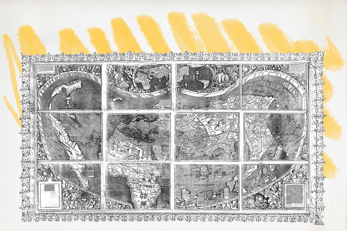
In 1507, a group of scholars in the small French town of Saint-Dié published a world map that changed how Europeans saw the globe — and gave “America” its name. Created by German cartographer Martin Waldseemüller and scholar Matthias Ringmann, the map was the first to show the New World as a separate continent, surrounded by ocean, rather than as part of Asia.
The two men drew on Portuguese nautical data and letters attributed to Florentine explorer Amerigo Vespucci to create the map. Though it later emerged they were doctored, the letters appeared to argue that Vespucci had found an entirely new landmass, not the eastern edge of Asia, as Christopher Columbus believed. Waldseemüller and Ringmann agreed with this idea — and in an accompanying book, Cosmographiae Introductio, they proposed naming this “fourth part” of the world “America,” after Vespucci’s Latinized first name, Americus.
Though Waldseemüller later dropped the name from his maps, others embraced it. When cartographer Gerardus Mercator applied the name “America” to the entire Western Hemisphere in 1538, it quickly became standard.
Only one copy of Waldseemüller’s 1507 map survives today — discovered in a German castle in 1901 and now housed at the Library of Congress in Washington, D.C. Sometimes called “America’s birth certificate,” it marks the moment when a new name — and a New World — entered the map of human understanding.